Wisconsin Bicycle Routes |
|||
|
Bicycle Route Notes |
|||
|
Waukesha County–Southern Section For simplicity, Waukesha County is divided into northern and southern sections, divided by the Glacial Drumlin Trail in the west and the New Berlin Trail in the east. In the southern section east-west routes are described first, followed by north-south routes. |
|||
|
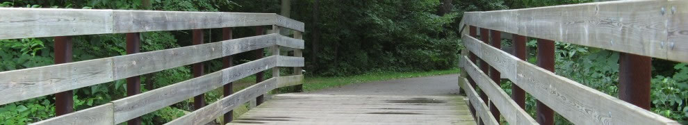
I. East-West Routes. A. Former Wisconsin Bike Route. The Milwaukee branch of this route follows Woods Road from Hales Corners to Henneberry Drive. Henneberry Drive is taken to Big Bend and Edgewood Avenue, which joins National Avenue (county ES, busy) to go into Mukwonago. Formerly this route continued on county ES to county J in Walworth County, but the latter route has become quite busy. The route shown on the map avoids downtown Mukwonago via various city and subdivision streets connecting to the new bike path along the south side of Eagle Lake Avenue (County LO) at the western edge of Mukwonago. Parking and portable johns are located at the eastern end of the bike path. This path ends at a new subdivision, whose roads can be followed to county I. The revised route follows county LO to Shearer Road, where it goes south to Bluff Road in Walworth County. 1. An alternative route from Hale’s Corners is to take Janesville Road to Big Bend. The traffic on this route is somewhat higher, but the road is fairly wide and seems quite friendly to bicycles. 2. A third alternative in this area is to take the unpaved Muskego Trail west from the Franklin trail in St. Martin’s. Then take either via Woods Road or Janesville Road. 3. Rather than turning on Henneberry Drive, one can continue south on county Y (can be busy). This road intersects the Seven Waters Trail to Burlington. 4. At Big Bend, one can continue southwest on Forest Home Avenue, either into Walworth County or by taking Maple Ave. to Mukwonago. This is a surprisingly rural and scenic area considering the population centers nearby. There is a new bicycle trail from the junction of Highway 83, and Maple into Mukwonago. B. New Berlin-Glacial Drumlin trails. The paved New Berlin Trail meets the Oak Leaf Trail in Milwaukee County’s Greenfield Park. During rush hour, several of the cross streets are a challenge to cross. This trail follows power lines and railroad tracks, but there are several wetlands near the western end. The trail ends on the eastern edge of Waukesha. Between the New Berlin and Glacial Drumlin trails, bicyclists traverse city streets to the Fox River and the Glacial Drumlin Trail. While the city has marked both northern and southern connecting routes, some of the signs are missing. The Glacial Drumlin State Trail is paved east of Dousman and crushed limestone west of it. East of Dousman, it is heavily used, going through rapidly developing suburbs. West of Dousman, it traverses extensive marshland (I counted one group of 15 sandhill cranes) and usage is much lower. Parking and restrooms are available in Wales and Dousman. II. North-South Routes and local routes. This description divides the southern portion of Waukesha County into three sections: the near suburbs of New Berlin and Muskego, Waukesha and points south, and the Kettle Moraine country. A. New Berlin and Muskego. 1. Sunnyslope Road. This is a reasonable north-south bicycling route from College Avenue north to the New Berlin recreation trail. 2. W College Ave. This is a winding east-west route with moderate traffic. One can continue west on Tans Drive and Town Line Road. 3. Moorland Road bike trail. A paved bike trail has been constructed along Moorland Road between the Muskego trail and Beloit Rd. 4. Little Muskego Lake. Both the west and east banks of this lake have routes suitable for biking. 5. Grange Avenue. This route continues from Milwaukee County to the west, eventually becoming Small Road and joining College Avenue. 6. Beloit Avenue. This is a continuation of a good route in Milwaukee County. To avoid National Avenue, the suggested route turns south on residential streets towards Little Muskego Lake. 7. New Berlin bike route. This is a marked route using residential streets and primitive bike trails from the new Berlin recreation trail south to Coffee Road. 8. Coffee Road. Runs from the New Berlin bike route to Racine Ave. and into Waukesha. A bike trail on the north side of National Avenue helps make the connection. 9. Cleveland Avenue. The most direct on-street route from Milwaukee County to Waukesha. Moderate traffic with shoulders. 10. Lincoln Ave. A low traffic alternative to Cleveland Avenue between Sunnyslope and Springdale Road. 1. Crowbar Road/Guthrie Road. This is a low traffic route between Racine County and Waukesha. 2. Big Bend Road. This is a low traffic route between Waukesha and points south. It connects to Center Drive through Skyline Avenue to continue south to Racine County. 3. Sunset Drive. This is a southern bypass of Waukesha, although the western end towards the Fox River Trail can be quite busy. 4. Fox River Trail. This trail runs from downtown Waukesha southwest to the intersection of County I and Lawnsdale Road. 5. Lawnsdale Road. A good east-west road except that the section between Oakdale and highway 164 can be busy. 6. Oakdale Road. Along with Big Bend Road, this is a connecting route between Waukesha and Mukwonago. 7. County I. This is a surprisingly rural route. The loops around Saylesville are very rural and scenic. 8. County D. With County H and Town Line Road, runs from the intersection of River Drive and Lawnsdale Road (Fox River Trail) into the Kettle Moraine at Ottawa. 1. Grush Road. With County ZZ, offers access to the Kettle Moraine and to the Ten Chimneys house in Genesee depot. 2. Waterville Road. This is a continuation of the Central Walworth Route. Go north on County E to North Prairie. At North Prairie, either jog west on highway 58 (shoulders, moderate traffic) to Piper Rd or continue north to ZZ. Follow the rustic road signs north for the next twenty miles (mostly Waterville Rd). When the rustic road ends, continue north on Waterville Rd. 3. Highway 67. Wide shoulders and moderate traffic. Offers access to the Kettle Moraine and Old World Wisconsin. 4. County G. A connection between Wales and Kettle Moraine. 5. Southwest of Dousman. Southwest of Dousman is a flat quiet area with a number of roads that are good for bicycling. Waukesha County–Northern Section The western part of Waukesha County is divided into two sections: the eastern sections up to Pewaukee and the lake country. I. Eastern Portion. This section includes the highly built up suburbs of Elmbrook, Brookfield, and Menomonee Falls, as well as more open areas to the west, many of which are rapidly developing. A. East-west through routes. The choice is limited. Routes are listed from south to north. 1. Brookfield. Brookfield is a maze for bicyclists. Generally traffic in Brookfield is heavy and roads are narrow. Over the years Brookfield has constructed a number of bike trails along its roads, but they tend to be short and discontinuous. These are shown on the map. A number of road sections have a bike lane on one side but not the other. Recently Brookfield has been constructing a system of bike trails in its parks, updating its map every year. a. Deer Creek Trail. This trail starts at the Oak Leaf trail a short distance south of Bluemound Rd. It goes under I 94 to emerge on the streets. The route follows streets to Mary Knoll park where it picks up a trail. Currently the trail ends at the western edge of the park. Temporary routes continue west using an extra wide sidewalk on Greenfield Ave. See the map for details. b. Bluemound Rd. Traffic on this road is very heavy and normally it would not be recommended. However from the Milwaukee county line to Goerkes Corners, the right-hand lane is limited to busses, bicycles and turning traffic. This makes Bluemound probably the safest commuting route for the cyclist who can tolerate the traffic. (1) A bike trail runs south from Goerkes Corners along the east side of Barker Road to Greenfield Ave. Unfortunately, Barker Road does not cut through to the New Berlin recreation trail. However, it is possible to go either east along Davidson Road and eventually connect to the New Berlin Bicycle Trail or to the Brookfield bike trails at Mary Noyes Park. A bike trail goes west on the south side of Greenfield Avenue to connect with Springfield Rd and the New Berlin Trail. c. Gephardt Road. This route extends west from Milwaukee County along the Watertown Plank Road. Where the Plank Road goes south west, the route continues west, and then angles on residential streets to Gephardt Road at Barker Road. The bicyclist must go north to pick up the North Avenue route. d. North Avenue route. This route goes to Pewaukee and the Lake country from Milwaukee through Brookfield. Some sections of North are paralleled by bike trails; others have bike lanes on one side or another. Traffic can be heavy at times. e. Beverly Hills Trail. This route runs between Wirth Park and the Fox Brook county park on a combination of paved trails and residential streets. It is well signed. f. Burleigh Road. This is a generally low traffic route across Brookfield that has several twists and turns. From Barker Road, it follows winding residential streets to get to Green Road, which it takes to Highway 164. At 164 the bicyclist can either (1) Take the bike trail south to Watertown Road and Pewaukee (see North Ave route) or (2) Go north to the trail’s end just north of Capitol Drive. It is possible to use the shopping center access roads and Cecilia Road to get to Pewaukee, avoiding the very busy Capitol Drive. 2. Menomonee Falls. a. Silver Spring Drive. This is a somewhat convoluted route from Milwaukee county to Pewaukee in Brookfield and Menomonee Falls. Between Milwaukee county and Pilgrim Road, this road is busy but has wide shoulders. Take the Pilgrim Road bike trail south and then use residential streets to cross to Marcy Rd. Take Marcy south and residential roads to cross to the Lisbon Rd bike trail west of Brookfield Rd. Take busy Lisbon Rd west a little under a mile to River Rd. Follow Wever Rd and Lindsay Rd to the north shore of Pewaukee Lake. b. Mill Road. A relatively low-traffic route to Pilgrim Road, where there is a bike trail. c. Good Hope Road. A bike trail runs on the north side of this road to Pilgrim Road, where it intersects another bike trail. d. Fond du Lac Avenue. This is the route from Milwaukee County’s Oak leaf Trail to the Bug Line Trail and Menomonee Falls, running along Fond du Lac Avenue, Roosevelt Drive and other city streets. e. Menomonee Avenue. Runs west from Fond du Lac Avenue to Town Line Road, and then continues west on Plainview Road. f. Menomonee River Trail. This runs through city parks, following the river from Fond du Lac Ave to downtown Menomonee Falls. The route then continues north across a pedestrian bridge over Highway 41 into Germantown. k. Bug Line Trail. This is a winding, mainly unpaved trail running from downtown Menomonee Falls through Lannon (views of quarries), Sussex, and to Merton. (1) Menomonee Park has swimming, bathrooms and parking. (2) Through Sussex, the trail follows city streets. A new paved bike path has been constructed north of Sussex to Maple Ave. following a power line. B. North-South routes (going west from Milwaukee) a. Elm Grove Rd/Lilly Road. This route starts at the New Berlin Trail where a short path connects to Elm Grove Rd. which runs north to Watertown Plank Road. It then follows various Elm Grove residential streets (it appears this may be an official Elm Grove bike route, at least for part of its length) to Lilly Rd. (Traffic on Lilly can be heavy at commuting times. For much of its length, it has a bike lane–but only on one side, as is true of other roads in Brookfield. From North Avenue to Burleigh, the lane is on the west. The lane then resumes on the west to Silver Spring, where it switches to the east until Good Hope, where it ends.) The route follows a bike path on the west side of Lilly from Burleigh to Keefe, where it switches to various local roads to Silver Spring. b. Pilgrim Road. This road runs from Bluemound north to Menomonee Falls. In Brookfield there is a mix of inconsistent bike lanes and bike paths. Between Bluemound and Wirth Park at North Ave there is a bike on the west side of the road. The path continues north to Pomona Rd. At that point the path ends and the suggested route switches to residential streets at Luella. In Menomonee Falls, the route rejoins the bike path along Pilgrim Rd. The path ends south of Appleton Ave so the route uses city streets into downtown Menomonee Falls. This continues north into Germantown using a pedestrian bridge over Highway 41. c. Marcy Road. This route runs from Davidson Road, south of Bluemound, to the Bug Line Trail. Like several other streets, Brookfield Rd has stretches of bike trails but they aren’t continuous and rush hour traffic can be heavy. Between Burleigh Road and Lisbon, it follows various residential streets to Marcy. (1) Lannon Road. At Lisbon the rider can go west to Lannon Road and then north to Menomonee Park. There is a short stretch of bicycle trail along Lisbon, but otherwise traffic can be heavy, particularly during rush hour. d. Highway 164 bike trail. This trail runs between Riverwood Drive, several miles north of I94, and Swan Road, north of Capitol Drive. Unfortunately, Highway 164 is not safe for bicyclists south of Riverwood and is not a good connector Waukesha. From the northern terminus of the trail, bicyclists can continue north on Swan Road to Lisbon Road and take that to the west. A. Waukesha routes to the west. 1. Madison Street. The street runs to the west from Waukesha, eventually turning south to the Glacial Drumlin Trail. This route is quite hilly, but scenic. The road is currently under construction and it may become less attractive as a bike route. 2. Grandview Boulevard. This is a winding road through residential areas from Madison Street south to the Glacial Drumlin Trail. 3. University Drive. This winding route runs from the County TT bike trail to the Glacial Drumlin Trail. 4. County TT bike trail. This trail parallels County TT from the Lake Country Trail south to Highway 18. At the southern end, neither of the highways is bicycle friendly, but one can take the sidewalk on the south side of 18 to Kisdon Hills Park where there is a bike trail that connects to Waukesha residential streets. B. East-West Routes 1. Lake Country Bike Trail. This trail runs from county JJ, west of County T, and Oconomowoc. Both the eastern and western sections are newly paved. The middle section, mostly through Nagawaukee county park was not paved at last report but there are future plans for paving. The eastern and western sections follow former interurban routes and are quite level. The middle section has several steep hils. Two additional sections, separated by roads, connect to Oconomowoc. Parking, restrooms, and water are available at the eastern end of the trail, near Sawyer Rd, and in Oconomowc. a. Getting to the Lake country bike trail from Waukesha. Probably the best route from downtown Waukesha is Delafield Street and Northview Road to the bike trail that parallels County TT. The County TT bike trail runs south from the Lake Country Trail. One guidebook shows a route using County T, which has the advantage of going to the start of the trail. However, County T is busy and has no shoulders. b. At Mill Rd there are a number of choices: (1) Waterville Road south. This road runs south to Waterville and beyond (see section on the south part of Waukesha county) (2) Mill Road, a Rustic Road running north. The route is very scenic and can be continued past Oconomowoc Lake to Oconomowoc. (3) Routes west. Three routes continue west from the end of the trail into Jefferson County. All have scenic portions but suffer from congestion and sprawl where they pass the Pabst Farms development. These include: (a) Genesee Lake Road. Connect to the Glacial Drumlin Trail via dead-end Indian Point Road. (b) Valley Road. 2. Mid-lakes Route. This route goes from Pewaukee to Oconomowoc, paralleling Highway 16, generally with low but fast traffic. 3. North-Lakes Route. This route starts at the intersection of Mill Rd and Marcy Rd and runs west. At Sussex the route splits. The southern branch takes Pewaukee Rd, Richmond Rd, Ainsworth Lane, Ryback Rd, and Beaver Lake Rd. The northern route follows the Bugline Trail to Merton. It then uses Sussex Rd to rejoin the southern route near Beaver Lake. It then follows Highway K. and Lang Road into Jefferson County. The section north of Okauchee Lake may be busy. 4. Northern Waukesha County Route. This route continues west from Plainview Road described earlier. It continues on Peterson Road, and then Mapleton Road to the west. The western part of this route is fairly level farmland. C. North-south routes 1. Wales-Hartland-Chenaqua. Starting at Wales, this route takes bike trails through Hartland, and continues north into the Monches area. a. From Wales to Buena Vista, there is a marked bicycle route mainly using residential streets. b. A bicycle trail runs north from the intersection of Maple and County K through Hartland. c. Roads in the Merton/Monches area. There are a large number of very scenic winding and hilly roads in this area leading north and west. These include Funk Road, Hoff Road, Lake Five Road, Center Oak Road and other roads in the North Lake area. 2. Kettle Marine Drive/Lakeland Drive. This route starts at the Glacial Drumlin Trail and runs north past Lapham Peak Park (mountain bike trails) and Nashotah Park. At Stone Bank it splits. One branch follows Westshore Drive into Washington County; the other, Enid Rd. 3. Dousman north to Oconomowoc. There are several possible routes between Dousman from Oconomowoc. Go north on Dousman Road (county Z) and then go west on one of several roads such as Valley Road to Golden Lake Road and take various small roads into the city of Oconomowoc. D. Lake shore routes. The glaciers left numerous lakes in northwestern Waukesha county. Some of the most interesting routes are described below. 1. Circling Pewaukee Lake. From Pewaukee, go west on Capitol Drive, and then Glacier Road. Take the bike trail south and then west to Maple Ave. Go south on Maple Avenue to Buena Vista. Take the Lake country Trail east, and then various streets back to Pewaukee. 2. Nagawicka Lake. A bike route follows the west shore of the late, using park roads at the south end. 3. Circling Lac la Belle. The west and north shores of this lake are very scenic, with the road located right at the water’s edge. Three short stretches of bike trail section of shore road to another. 4. Oconomowoc Lake. There is a scenic shore route along the west shore of Oconomowoc Lake. |
|||